Communities emerge
In the beginning, the fortune-seekers panned the creeks and rivers searching for alluvial gold, constantly moving on at the news of another find. But gold was also deep within the earth, where ancient river beds had been buried by volcanoes. In Ballarat in 1852 the first shafts were dug, and because the work was unsafe and arduous, the men joined in bands of eight or ten, usually grouped by nationality, working a common claim. For deep mining, diggers stayed in one place for months or years, and the major workings rapidly became stable communities with banks, shops, hotels, churches and theatres, evolving more gradually, on the back of income from gold, into grandiose towns.
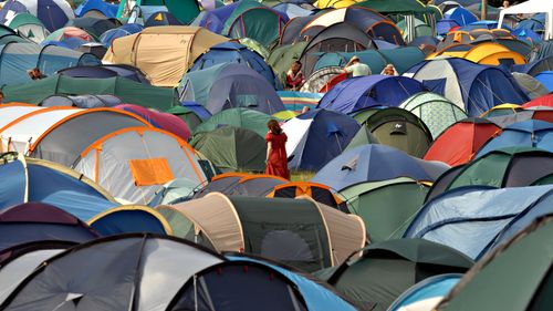
Maldon Folk Festival
During the long weekend before the Melbourne Cup (first weekend of Nov), things get a bit busier than usual as people head to Maldon for the four-day Maldon Folk Festival (maldonfolkfestival.com). Since its inception in 1974 the event has steadily grown, and apart from folk, it features blues, bluegrass and world music as well as theatre and dance. The main performance space is at the Tarrangower Reserve at the base of Mount Tarrangower, just out of town, but there are also free events in town.
Gippsland
GIPPSLAND stretches southeast of Melbourne from Western Port Bay to the New South Wales border, between the Great Dividing Range and Bass Strait. Green and well watered, it’s been the centre of Victoria’s dairy industry since the 1880s, although the Latrobe Valley (particularly around Morwell) is home to industrial areas, coal mines and power stations. South Gippsland has Victoria’s most popular national park, Wilsons Promontory, or “The Prom”, a hook-shaped landmass jutting out into the strait, with some superb scenery and fascinating bushwalks. In the east, around the Gippsland Lakes and Ninety Mile Beach, the region is beautifully untouched, and just beyond Orbost–Marlo the unspoilt coastline of the Croajingolong National Park – with its rocky capes, high sand dunes and endless sandy beaches – stretches to the New South Wales border. Mount Baw Baw, an alpine resort off the freeway from Moe (80km west of Sale), presents a very different aspect of the Gippsland region, offering skiing and snowboarding in winter and bushwalking in summer.
Bataluk Cultural Trail
Encompassing eleven sites, scattered between Yarram near Wilsons Promontory and Cape Conran in the east, the Bataluk Cultural Trail (batalukculturaltrail.com.au) links places of cultural and spiritual significance to the Gunaikurnai people, the original inhabitants of the Gippsland coast who have lived here for more than 30,000 years. The sites include shell middens and scarred trees; a cave, the Den of Nargun in the Mitchell River National Park, 25km northwest of Bairnsdale; and the fascinating Krowathunkoolong Keeping Place in Bairnsdale.
Black Saturday bushfires
February 7, 2009 will be forever etched on most Victorians’ minds as the start of Australia’s worst ever bushfires. “Black Saturday”, as it is known, killed more than 170 people and thousands of animals, destroyed more than a million acres of bushland, wiped out townships and left 7500 homeless. Residents in Victoria’s southeast were told to prepare for extreme conditions the day before; temperatures exceeding 47ºC and winds of up to 120km/hr were predicted, combined with tinder-dry land due to the previous week’s heatwave and long-term drought. In the Gippsland region a fire was started deliberately in Churchill and quickly spread to surrounding areas. Fires also destroyed thousands of acres of bushland in Wilsons Promontory.
Always check with Parks Victoria (parks.vic.gov.au) before setting out during the summer months and familiarize yourself with bushfire safety tips.
Wilsons Promontory
WILSONS PROMONTORY, or “the Prom”, the most southerly part of the Australian mainland, was once joined by a land bridge to Tasmania. Its barbed hook juts out into Bass Strait, with a rocky coastline interspersed with sheltered sandy bays and coves; the coastal scenery is made even more stunning by the backdrop of granite ranges. It’s understandably Victoria’s most popular national park, and though the main campsite gets totally packed in summer, there are plenty of walking tracks and opportunities for bushcamping, and the park is big enough to allow you to escape the crowds. You can swim at several of the beaches and even surf.
The nearest town is the dairying settlement of Foster on the South Gippsland Highway, a 30-minute drive away and the best place to buy groceries, fuel and other supplies. Situated by a small river on Norman Bay, Tidal River is the national park’s main camping and accommodation centre, with a general store (daily 9am–4pm) including a pricey supermarket and takeaway food.
Walks
Many short walks begin from Tidal River, including a track accessible to wheelchairs. During summer holidays and on weekends between November and the end of April, the tracks become extremely busy so show up early, and book well in advance if you intend to camp. Although the remote north of the park offers some short well-signposted walks, the longer (overnight) hikes are suitable only for experienced, properly equipped bushwalkers, as there are no facilities and limited fresh water.
One of the best walks is the Squeaky Beach Track (1hr 30min return), which crosses Tidal River, heads uphill and through a tea-tree canopy, finally ending on a beach of pure quartz sand that is indeed squeaky underfoot. The Lilly Pilly Gully Nature Walk (2hr return) is also very rewarding, as it affords an excellent overview of the diverse vegetation of “the Prom”, from low-growing shrubs to heathland to open eucalypt forest, as well as scenic views. The walk starts at the Lilly Pilly Gully car park near Tidal River.
The tracks in the southern section of the park are well defined and not too difficult; the campsites here have pit toilets and there is fresh water, although this is creek water and it needs to be treated. The most popular walk is the one- to two-day (35.5km) Sealers Cove–Refuge Cove–Waterloo Bay route, beginning and ending at the Telegraph Saddle car park.
The Great Ocean Road
The Great Ocean Road (visitgreatoceanroad.org.au), Victoria’s famous southwestern coastal route, starts at Torquay, just over 20km south of Geelong, and extends 285km west to Warrnambool. It was built between 1919 and 1932 with the idea of constructing a scenic road of world repute, equalling California’s Pacific Coast Highway – and it certainly lives up to its reputation. The road was to be both a memorial to the soldiers who had died in World War I and an employment scheme for those who returned. More than three thousand ex-servicemen laboured with picks and shovels, carving the road along Australia’s most rugged and densely forested coastline; the task was speeded up with the help of the jobless during the Great Depression.
The road hugs the coastline between Torquay and Apollo Bay and passes through the popular holiday towns of Anglesea and Lorne, set below the Otway Ranges. From Apollo Bay the road heads inland, through the towering forests of the Great Otway National Park, before rejoining the coast at Princetown to wind along the shore for the entire length of the Port Campbell National Park. This stretch from Moonlight Head to Port Fairy, sometimes referred to as the “Shipwreck Coast”, is the most spectacular – there are two hundred known shipwrecks here, victims of the imprecise navigation tools of the mid-nineteenth century, the rough Southern Ocean and dramatic rock formations such as the Twelve Apostles.
From Warrnambool, the small regional centre where the Great Ocean Road ends, the Princes Highway continues along the coast, through quaint seaside Port Fairy and industrial Portland, before turning inland for the final stretch to the South Australian border.
Hiking the Great Ocean Road
Walking and hiking enthusiasts can choose between two magnificent walking tracks along the coast: the Great Ocean Walk (greatoceanwalk.com.au), a 104km track from Apollo Bay to Gibson Steps 1km east of the Twelve Apostles, and the long-established Great South West Walk (greatsouthwestwalk.com), a superb 250km circuit starting from just outside Portland. Further sources of information include Parks Victoria (parks.vic.gov.au) and the Department of Sustainability and Environment Information Centre at 8 Nicholson St, East Melbourne (dse.vic.gov.au).
Portland
PORTLAND likes to describe itself as the “Birthplace of Victoria”. Indeed, there are quite a few historic buildings, but unlike Port Fairy they don’t add up to form a coherent, captivating townscape. It’s the last stop on the Victoria coast going west on the Princes Highway, but Nelson, a friendly fishing village further west, or Port Fairy make for more atmospheric overnight stops between Melbourne and Adelaide. The rugged coastal scenery to the southwest around Cape Nelson and Cape Bridgewater, however, is not to be missed.
The Portland Cable tram
A restored and modified vintage cable tram (portlandcabletrams.com.au) transports sightseers along the foreshore on a round trip of 7.5km, from the depot at Henty Park past the Powerhouse Motor and Car Museum to Fawthrop Lagoon (home to pelicans), then back through the Botanic Gardens.
The Murray region
From its source close to Mount Kosciuszko high in the Australian Alps, the Murray River runs for around 2700km and forms the border between Victoria and New South Wales until it crosses into South Australia (someone got a ruler out for the rest of the border to the coast), and although the actual watercourse is in New South Wales, the Victoria bank is far more interesting and more populous. After the entire length was navigated in 1836, the river became the route along which cattle were driven from New South Wales to the newly established town of Adelaide, and later in the century there was a thriving paddle-steamer trade on the lower reaches of the river, from Wentworth on the New South Wales side and Mildura through to Echuca.
In 1864, Echuca was linked by railway to Melbourne, stimulating the river trade in the upper reaches, and thus became a major inland port, the furthest extent of the navigable river. At the height of the paddle-steamer era, Mildura was still a run-down, rabbit-infested cattle station, but in 1887 the Chaffey brothers, brought over from Canada, instituted irrigation projects that now support dairy farms, vineyards, vegetable farms and citrus orchards throughout northwestern Victoria. Between Mildura and Echuca, Swan Hill marks the transition to sheep, cattle and wheat country; the Pioneer Settlement here explores the extraordinarily hard lives of the early settlers. Above Echuca the Murray flows through more settled regions, but also the Barmah wetlands, an ecosystem of international significance.
Nowadays paddle steamers cruise for leisure, and are the best way to enjoy the river and admire magnificent river red gums lining its banks, as well as the huge array of birds and other wildlife that the Murray sustains. Renting a houseboat is also a relaxing (if expensive) way to travel.